quote

Tune in Earthfiles YouTube Channel LIVE Wednesdays
@ 9:30pm Eastern/6:30pm Pacific — youtube.com/earthfiles

YouTube link
Special Earthfiles YouTube Channel interview
with Earthfiles Reporter and Editor Linda Moulton Howe.

Classified NOSS Navy Satellites Offered As Dover Triangle Explanation

"Each NOSS launch placed a cluster of one primary satellite and three smaller sub-satellites (that trail along at distances of several hundred kilometers) into low polar orbit. This satellite array can determine the location of radio and radars transmitters, using triangulation, and the identity of naval units, by analysis of the operating frequencies and transmission patterns. NOSS used the ELINT (Electronic Intelligence) technique called 'time difference of arrival,' TDOA, rather than true interferometry."


 - Space Policy Agency: Military Space Programs: about White Cloud NOSS

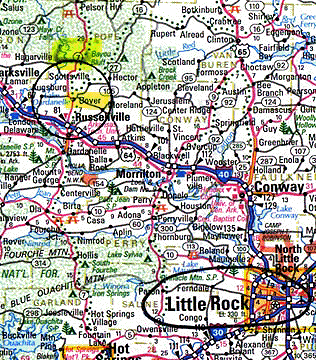
April 27, 2002  Dover, Arkansas - Since my Earthfiles and Coast to Coast AM radio report on April 23-24, 2002, I have received several e-mails from viewers about the United States Naval Ocean Surveillance System (NOSS) satellite group as an explanation for the April 14, 2002 moving triangle of "stars" sighting described in the 04/22/02 Earthfiles. These satellites were not acknowledged by the United States government as officially existing prior to 1996, even though the first experimental ones were launched in the early 1970s. Even today, for national security reasons, Navy intelligence does not want information about NOSS known in the general public. Aiding that secrecy, the trios of satellites are not easily seen with the naked human eye.


Click here to subscribe and get instant access to read this report.

Click here to check your existing subscription status.

Existing members, login below:

Earth’s Magnetic Anomalies – Could the Poles Flip?

Computer-generated snapshot of lines of force in the Earth's magnetic field beginning at the Earth's surface from where they penetrate smoothly into the insulating mantle. The structure changes dramatically in the liquid core below the mantle where the magnetic field is generated by the convection of the core's melted iron. Graphic courtesy Gary A. Glatzmaier, EE-IGPP, Los Alamos National Laboratory and Paul Roberts, University of California-Los Angeles.

April 27, 2002  Cambridge, Massachusetts - Deep beneath our feet as we walk around ­ in fact, 4,000 miles down ­ is the center of the earth where an iron core is so hot it is liquid and boils around like cooking porridge. That moving, melted iron also produces the magnetic fields that surround the earth and upon which much of earth's surface life, satellites and space technology depend upon for orientation, and for protection. If magnetic fields did not trap highly energetic particles racing from the sun, all kinds of damage could be done to living organisms and space technologies. For nearly a million years, magnetic field lines have been coming out of the south pole and entering the north pole of the earth. That is called the magnetic dipole.


Click here to subscribe and get instant access to read this report.

Click here to check your existing subscription status.

Existing members, login below:

John Anthony West Organizing New Effort to Date Weathering of Sphinx and Red Pyramid Chamber

A 20th Century photograph of the Sphinx showing weathering and damage from deliberate attacks over the ages, Cairo, Egypt. The Sphinx was carved, method unknown, from one single ridge of stone that was 240ft long. Its length is 150 feet and the paws alone are 50 feet. Its height is 66 feet. The head measures 30 feet long and 14 feet wide.

April 23, 2002  Athens, New York - In 1991, Egypt researcher John Anthony West joined Boston University geologist, Robert Schoch, Ph.D., to study the weathering on the base of the Sphinx. Dr. Schoch's academic opinion was water damage at least eight thousand years ago and the two men announced their theory which made worldwide headlines. Since then, two British geologists named David Coxill and Colin Reader have independently traveled to Cairo to study the Sphinx and each has supported Dr. Schoch's conclusion that the weathering is from water. But no one yet has definitively proved how long ago there was enough rain to weather the Sphinx.


Click here to subscribe and get instant access to read this report.

Click here to check your existing subscription status.

Existing members, login below:

Triangle Formation of Moving “Stars” Over Dover, Arkansas

The Piney River valley ten miles north of Dover, Arkansas and northwest of Little Rock has a long tradition of mysterious moving lights and green fog. Local residents call them the "Dover lights."

April 22, 2002  Dover, Arkansas - A week ago on Sunday night, April 14, 2002, I was in the Ozark National Forest of northwest Arkansas with eight other people. There was no moon and the clear sky was vivid with stars at 11 p.m. Central Daylight Time. We were there to look for the mysterious lights that have long been reported in the Piney River valley ten miles north of Dover.


Click here to subscribe and get instant access to read this report.

Click here to check your existing subscription status.

Existing members, login below:

Canadian and American Officials In 1950s Collaborated on Study of Unidentified Aerial Disks

“It can be deduced that the vehicles (unidentified disks) have the following significant characteristics. They are a hundred feet or more in diameter; they can travel at speeds of several thousand miles per hour; they can reach altitudes well above those, which would support conventional aircraft or balloons; and ample power and force seem to be available for all required manoeuvres. Taking these factors into account, it is difficult to reconcile this performanc with the capabilities of our technology, and unless the technology of some terrestrial nation is much more advanced than is generally known, we are forced to the conclusion that the vehicles are probably extraterrestrial, in spite of our prejudices to the contrary.”

- From an August 1952, classified report to Project Magnet
for Canada's Department of Transportation, by Wilbert B. Smith,
Project Magnet Director, DOT, Ottawa


April 20, 2002  Winnipeg, Manitoba, Canada - Unknown to Canadian and American citizens during the Eisenhower administration of the early 1950s, the Project Magnet Director of Canada's Department of Transport was working intimately with the highest offices in military, intelligence and the White House in Washington, D. C. Wilbert Brockhouse Smith was an engineer who organized Project Magnet, Canada's official investigation of the “flying saucers” and the theory that their mode of propulsion utilized the magnetic fields of the earth and solar system.


Click here to subscribe and get instant access to read this report.

Click here to check your existing subscription status.

Existing members, login below:

Part 2 – Unidentified Aerial Craft Over Farmington and Aztec, New Mexico, Around Spring 1949

April 17, 2002  Aztec, New Mexico - A month ago on March 16, 2002, I posted an Earthfiles report in Real X-Files about the 52nd anniversary of a huge, fly-over of unidentified silver and orange disks for hours above Farmington and Aztec, New Mexico, on March 17, 1950. The next day, March 18, 1950, the unprecedented aerial event made headlines in the Farmington Daily Times and The Denver Post.


March 18, 1950, Farmington Daily Times, Farmington, New Mexico.


Click here to subscribe and get instant access to read this report.

Click here to check your existing subscription status.

Existing members, login below:

Chronic Wasting Disease Spreads to Wisconsin White-Tailed Dee

The Wisconsin Department of Natural Resources haas confirmed ten cases of deadly chronic wasting disease (CWD) in wild white-tailed deer, the first such cases east of the Mississippi River. Photograph © 2001 by Roger Barbour Kuhn.


April 6, 2002  Madison, Wisconsin - On February 28th, the Wisconsin Department of Natural Resources (DNR) confirmed three cases of deadly chronic wasting disease (CWD) in free ranging white-tailed deer in the Mount Horeb area of western Dane County. This week that number jumped to ten. Since March 5, 2002, the DNR has collected 197 deer samples from that region and plans to collect 300 more. CWD is a prion disease that attacks brains and nervous systems similar to mad cow in cattle, scrapie in sheep and new variant Creutzfeldt-Jakob and kuru in humans. The culprit in both animals and humans is called a prion. Prion stands for proteinaceous infectious particles. More simply, prions start out as normal proteins that mysteriously change shape and then destroy brain and nerve tissue. To this date, no one knows what caused the proteins to change shape in the first place or how misshapen proteins are transmitted. There is no blood test to find prions while animals are alive and no cure after prions are confirmed. Death usually occurs within weeks or months.


Click here to subscribe and get instant access to read this report.

Click here to check your existing subscription status.

Existing members, login below:

Scientists Investigate Dark Coastal Waters of Southwest Florida

NASA showed this March 21, 2002 Goddard Space Flight Center SeaWiFS image captioned, "Mysterious black water blankets Florida Bay." The dark water between Naples and the Florida Keys was first reported by fishermen and pilots back in January. By the middleof March, the dark waters had spread to an estimated 100 miles and scientists began to take and analyze water samples. Satellite image courtesy NASA.


April 1, 2002  Marathon, Florida - Fishermen who have spent their lives catching marine life in the waters between Naples and the Florida Keys began calling news media in January to report massive areas of water so dark and dense it was eerie and many said they had never seen anything like it before. By the middle of March, NASA satellite images clearly showed dark waters that at one point spanned an estimated 100 miles. Fishermen also noted that dead plants from the ocean floor seemed to rise up and follow the movement of the dark water through Florida Bay and the Keys. Fish seemed to turn away from the dark currents and eventually scientists discovered that coral and sponges had died or were dying in certain channels where the dark waters had been.


Click here to subscribe and get instant access to read this report.

Click here to check your existing subscription status.

Existing members, login below:

Drought Worsens in United States

"If we don't have replenishing rains that really begin to fill the reservoirs and ... start refilling some of the groundwater tables, then we're going to continue to deplete our water resources and the economic and environmental impacts of that are going to just be devastating."

- Don Wilhite, Director, National Drought Mitigation Center,
University of Nebraska, Lincoln, March 29, 2002


Graphic of intensifying drought in the U.S., February 9 - March 15, 2002, courtesy National Drought Mitigation Center, University of Nebraska, Lincoln, Nebraska.


March 30, 2002  Narrowsburg, New York - Since the dry, warm fall and winter of 2001-2002, rivers on the East Coast of the United States have reached the lowest levels on record. In December, it was so bad in the Cannonsville Reservoir of the Delaware River watershed that its muddy bottom was exposed for the first time since it was built. That reservoir, which helps provide water to Manhattan, had only 3% of its water capacity. In fact, half the drinking water for New York City comes from three reservoirs in the Delaware River watershed and all three right now have less than half their normal water levels.


Click here to subscribe and get instant access to read this report.

Click here to check your existing subscription status.

Existing members, login below:

Antarctic Peninsula Is Melting – And So Is Arctic Ice

"This was the warmest summer (2002) in the Antarctic Peninsula to date. The Antarctic Peninsula has one of the steepest warming trends of anywhere on earth and this event, the collapse of the Larsen B ice shelf, was the largest event of its kind in the last 30 years."

- Ted Scambos, Ph.D., Glaciologist,
Univ. of Colorado

The Antarctic South Pole is covered by a continent the size of the United States. The Antarctic ice sheet which is 1.5 miles thick in some places, contains over 90% of the world's fresh water. The Antarctic Peninsula ice sheets that extend into the surrounding seas are melting rapidly, whether from global warming or local climate variations.


March 21, 2002  Boulder, Colorado - Scientists have been warning since 1997 that the Antarctic Peninsula and its Larsen B ice shelf were melting, but no one expected that by March 2002 the Larsen B would have disintegrated to only 40% of the size it was five years ago. But it has and in its collapse, one of the largest floating ice masses of the past thirty years has broken off. Nearly twice the size of Rhode Island covering 2,160 square miles (3,250 square kilometers) and 750 miles thick, iceberg B-22 was photographed on March 11, 2002 by the AVHRR satellite and reported by NOAA, the National Ice Center (NIC) and the University of Colorado's National Snow and Ice Data Center. The ice shelf has existed since the last ice age 12,000 years ago, and yet it disintegrated suddenly over a 35 day period that began the end of January 2002.


Click here to subscribe and get instant access to read this report.

Click here to check your existing subscription status.

Existing members, login below: