


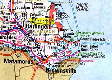
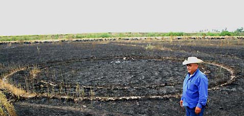
Updated September 20, 2006 (Originally filed September 14, 2006) Rio Hondo, Texas – Today I talked with reporter Allen Essex at the Valley Morning Star newspaper in Harlingen, Texas. Allen visited the site of the concentric rings with Star photographer, Joe Hermosa, earlier this week. There were three sets of rings all the same diameter “pressed down into the ground as if something very heavy had set down,” said Allen Essex. “All of the rings were pressed about five inches into the ground and at the bottom of the rings were crushed weeds. The rings in the photograph were the most distinct. The other two sets of rings were not quite as clear.”
I asked Joe Hermosa if he photographed all three sets of double rings and he said he did not because he would have to get too far away to get all three in the frame. He estimated that each pair of rings was separated from the others by about twenty to twenty-five feet. “But the three sets of rings were not in a straight line or in a triangle or anything like that,” said Essex. “It was just like something round and very heavy had set down three different times in the general area.”
“I thought about UFOs,” said Essex, “and I wanted to know if there was any radiation in the rings. So, I gathered some of the soil and took it to a hazardous waste material place. They tested the soil with a geiger counter, but it wasn’t much above background.”
Beatriz Huerta, Arnulfo’s wife, and their son, Marine Corps Lance Cpl. Armin Huerta (temporarily home from Iraq and now on travel again), noticed the three sets of concentric rings about 5:30 p.m., on Thursday, September 7, 2006. Arnulfo Huerta told Allen Essex, “We hadn’t noticed them before. You can see that the grass was too high to see them (before the burning).” Huerta said he got a burning permit from the Rio Hondo fire chief because the weeds were so full of ticks.
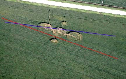
Allen Essex and Joe Hermosa from the Valley Morning Star measured the ring diameters. Essex reported that “the diameter of the most distinct set of round marks is 47 feet, 8 inches for the outside circle and 37 feet, 5 inches for the inner circle.” He told me that the other rings in the other two sets seemed to be the same size.
Essex talked to a Cameron County road crew working about two miles from the Huerta property, who said there were no signs of heavy vehicles or equipment anywhere around where the concentric rings were found.
Christmas Eve 2004 – A Bright Light Over Field
The Huertas told Essex that on Christmas Eve in December 2004, their son, Armin, saw a bright light right over the weed field where the concentric rings have now been discovered. Arnulfo told Essex, “My wife and I were at a birthday party and he (Armin) called us. He was real excited. There was a blue light, right out here where these circles are. Armin told us it lit up the whole inside of the house as if it were daytime.” The Huertas realized their son was nervous about the brightness of the light and he did not go outside to see the source. Now the Huertas wonder if the bright, blue light might have landed three times in the weeds two years ago for reasons unknown.
September 19, 2006 Email Update:
C. B. in Utica, Mississipi, emailed today: “In the mid-winter of the early 1970s, I was a teenager doing one of my farm chores of checking the perimeter fences on my father’s farm in Claiborne County, Mississippi. The farm is about fifteen miles south of Utica, Mississippi. We had cattle and my father wanted the perimeter fences checked daily. While heading back to the house on my horse, I found three perfectly flattened circles in the field a few hundred feet from our house.
“They were not concentric rings cut into the ground like those in the Rio Hondo, Texas, photograph on your Earthfiles webpage. The three depressions were perfectly round filled areas and about three feet apart. It was as if three extremely heavy perfectly flat round surfaces about 15 feet wide landed there and crushed the dried brush and grass till the pieces separated from the pressure. Or, maybe whatever it was landed, rose again, landed close by, rose again, and landed again close by. Whatever it was, it was quiet to have been so massively heavy.
“They were large and close together. I brought my father and mother to these large flattened areas to get their opinion. They didn’t know what to make of them. My father was a retired Marine drill instructor with military service during WW2 and a highly trained observer, but this really puzzled him. Had we burned the dried weeds away like this (Rio Hondo) rancher did, we might have even found rings like his.
“Whatever made those perfectly round flattened areas had to have weighed several tons or more to flatten out the tall, stiff brush so perfectly. I can drive my nearly two ton Ford pickup over the same kind of dried brush and can’t get it to flatten out the way that area was back then. That dried brush was completely crushed by something that came down on it from above. By that, I mean the stems of the dried dog fennel themselves were crushed and pulled apart. Whatever the craft was, it came straight down, too. The dried grasses weren’t twirled or twisted like crop circles I’ve heard about. And these three areas were not a deer bed or places where the cattle herd had lain in the night. The outer lines were too perfect. A cattle herd bunched up and sleeping on the ground like that would not have made depressions in the brush that perfectly round.
“Those rings had not been there the day before either. I would have seen them because I rode my horse a lot back then in the pasture behind the house checking on the cattle and perimeter fences.
“Back in August of 1979 I was twenty-one years old. I witnessed three UFOs come in from the east, west, and south and hover over this same farm. They looked like glowing balls of light. At first I thought they were helicopters because it was National Guard Weekend and helicopters flew over the farm all the time during National Guard Weekend. I estimate they hovered about a half a mile up for ten minutes. Then the UFOs quickly moved a 90 degree direction from their original flight path then suddenly shot off across the horizon at a 45 degree angle from the point they moved to. By example, I mean that the UFO from the west moved quickly south-west then zoomed north-east. How those three UFOs didn’t collide at those speeds is amazing. I just stood there with my mouth wide opened at what I had just witnessed. At those fantastic speeds, anything with a blood pulse would have died – or so I reasoned with my very very limited knowledge of space flight and UFOs.”
More Information:
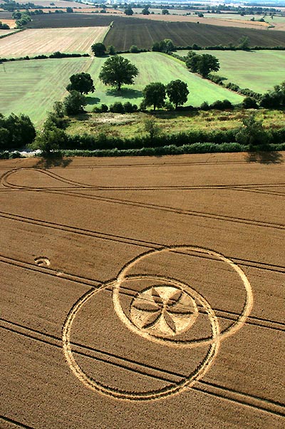
For further information about crop formations, please see reports below and going back to 1999 in the Earthfiles Archives and my book, Mysterious Lights and Crop Circles in the Earthfiles Shop:
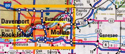
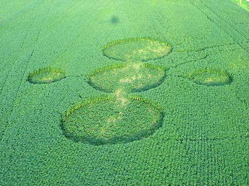
- 09/06/2006 — Part 4: Five Circle Pattern in Geneseo, Illinois, Soybeans
- 08/31/2006 — Part 3: Five Circle Pattern in Geneseo, Illinois, Soybeans
- 08/28/2006 — Part 2: Five Circle Pattern in Geneseo, Illinois, Soybeans
- 08/27/2006 — Part 1: Five Circle Pattern in Geneseo, Illinois, Soybeans
- 08/17/2006 — Military Helicopter Aggression Toward Red Sphere in U. K.
- 08/16/2006 — Etchilhampton August 15, 2006, Wheat Formation
- 08/15/2006 — Part 2 – Three Crop Formations Near Uffington White Horse – A “Merkabah?”
- 08/13/2006 — Part 1: Three Crop Formations Near Uffington White Horse
- 07/21/2006 — U. K. Breaking Heat Records and 17 Crop Patterns Reported Between July 4 – 20
- 07/07/2006 — Anomalies in Huntingburg, Indiana, Wheat Pictogram
- 06/11/2006 — Updated: Two Mysterious Circles in Wheat Baffle Kansas Farmer
- 04/07/2006 — First 2006 Grass Circles in Conondale, Queensland, Australia
- 09/21/2005 — Silent, Unidentified Aerial Triangle Entered Thunderstorm Over Fairborn, Ohio
- 09/02/2005 — “Mayan Clock”? in August U. K. Crop Formations
- 09/02/2005 — Part 1: New York and Ohio Corn Circles “Flattened 2 to 5 Feet Above Ground”
- 09/02/2005 — Part 2: Mysterious Lights At Coles County, Illinois, Corn Circles
- 09/02/2005 — First 2005 Canadian Crop Circles Reported
- 08/09/2005 — Three Extraordinary U. K. Crop Formations Reported August 9, 2005
- 08/07/2005 — Mysterious Light Photographed in Canadian Woods
- 08/02/2005 — Part 2: Anomalies Confirmed in Pennsylvania and Arizona Randomly Downed Crops
- 08/02/2005 — Part 1: Anomalies Confirmed in Pennsylvania and Arizona Randomly Downed Crops
- 07/23/2005 — Mystery of Six Grass Circle Formations in North Carolina
- 07/18/2005 — Garsington, Oxfordshire, U.K. Wheat Formation – Astronomical Orbit?
- 07/01/2005 — U. K. Bicyclist Reports Mysterious, Low Hovering Objects Bending Wheat
- 06/28/2005 — Crop Circles in Poland
- 06/02/2005 — Part 2 – Highly Anomalous Pigment Formation in 2004 Hillsboro, Ohio, Crop Formation
- 05/26/2005 — Phoenix Barley Mystery: Apparently Irrigation and Wind
- 05/20/2005 — May 2005 Crop Formation Update in Six Countries
- 05/09/2005 — Mysterious Lights and 2003 Serpent Mound Soybean Formation
- 04/20/2005 — Outer Space Impact At Serpent Mound, Ohio, 256 Million Years Ago
- 04/12/2005 — First 2005 Dutch Crop Circles Reported in Hoeven, Holland Grass
- 10/17/2004 — American Crop Formations: 1880-2004
- 09/22/2004 — Miamisburg and Serpent Mound, Ohio Crop Formations: Geometries Compared
- 09/17/2004 — Updated: Part 1 – High Strangeness in Canadian Cattle Corn
- 09/12/2004 — Part 2 – High Strangeness in Canadian Cattle Corn
- 09/10/2004 — Update on Miamisburg, Ohio, Corn Pictogram – Balls of Light?
- 09/05/2004 — Part 2 – Hillsboro, Ohio Corn Plant Anomalies
- 09/04/2004 — Hillsboro, Ohio Corn Formation – High Strangeness in Soil and Plants
- 09/02/2004 — Updated Photos: Big, Impressive New Corn Formation in Miamisburg, Ohio
- 08/29/2004 — Another Pictogram in Poland
- 08/12/2004 — Circles in Belgium and Holland
- 08/10/2004 — Updated Aerial Photos of West Overton, Wiltshire “Serpent”
- 08/09/2004 — Pictograms in Poland
- 08/03/2004 — Crop Formations: Fifteen in Southern England Since July 20, 2004.
- 07/26/2004 — Crop Circles in Tilden, Wisconsin Oats and 90-Degree Angles in Litchfield, Minnesota
- 07/25/2004 — 2004 Canadian Crop Formations: Scorched Soybeans and “Dirt” Pattern in Barley
- 07/24/2004 — Part 3 – Crop Formations and Mysterious Lights in Wiltshire, England, July 2004
- 07/24/2004 — Part 2: Crop Formations and Mysterious Lights in Wiltshire, England, July 2004
- 07/15/2004 — Updated: Part 1-Beyond Hillsboro, Ohio, More Corn Down in New Milford, Connecticut
- 07/13/2004 — Updates on Spanish Fork, Utah Barley Formation
- 07/07/2004 — Fourth 2004 Crop Formation in Poland Has Multiple Parts
- 07/06/2004 — Mysteriously Downed Plants in Eagle Grove, Iowa, and Hillsboro, Ohio
- 07/06/2004 — Additions to Spanish Fork, Utah Formation and Mysterious Lights Seen
- 07/04/2004 — Crop Formation in Spanish Fork, Utah
- 06/17/2004 — More 2004 Holland and Poland Crop Formations
- 06/16/2004 — England: 2004 Crop Formations and 2003 Research
- 06/03/2004 — Updated – Second 2004 Pictogram Crop Formation in Poland
- 06/02/2004 — 2004 Peach Orchard, Arkansas Crop Formation
- 05/24/2004 — Biophysicist W. C. Levengood’s Crop Circle Reports Available for First Time On Internet
- 05/22/2004 — 2004 Overview of Crop Formations in Six Countries
- 05/17/2004 — Updated – Crop Formation Reported in Zabno, Poland
- 05/11/2004 — An Extraordinary Photograph in A Dutch Home
- 05/09/2004 — 2003 English Crop Formations on Documentary DVDs
- 04/14/2004 — Light Anomalies in Photos of Conondale, Australia Grass Circles
- 12/05/2003 — Diatonic Ratios and Seed Changes in 2003 California Wheat Circles Rule Out Hoax?
- 11/07/2003 — British UFO Crash Retrievals
- 11/01/2003 — Another Soybean Formation in Ohio
- 10/17/2003 — 2003 “UFO Flap” in Ohio
- 10/03/2003 — Part 2 – Military Interest in Serpent Mound and Seip Mound Formations?
- 10/02/2003 — Part 1 – Another Soybean Formation Near Seip Mound in Ohio
- 09/12/2003 — Second Soybean Crop Formation in Ohio is Manmade. USAF Investigation Unit Involved?
- 09/06/2003 — Part 2 – Unusual Soybean Formation Near Serpent Mound, Ohio
- 09/05/2003 — Part 1 – Unusual Soybean Formation Near Serpent Mound, Ohio
- 09/03/2003 — Helicopter “Attacks” Wiltshire, England, Residents At Knap Hill on August 26, 2003
- 08/29/2003 — Part 2 – After August 10, No Crop Formations Except in Canada?
- 08/29/2003 — Part 1 – Why Do Military Helicopters Focus On Crop Formations?
- 08/23/2003 — Fourteen Crop Formations in Canada
- 08/05/2003 — Field Notes from Morgan’s Hill Crop Circle
- 08/01/2003 — Field Notes About English Animal Mutilations
- 07/21/2003 — Strange Orange Lightning and A Sampling of Recent English Crop Formations
- 07/19/2003 — Update – Defiance, Missouri T-Pattern Cut in Saplings
- 07/17/2003 — Land Surveyor Comments About Ogbourne St. George, U.K. Crop Formation
- 07/16/2003 — Unusual Details in Dutch Crop Formations
- 07/11/2003 — Updated: Part 2 – Unusual Cylindar-Shaped Cloud Seen Night Before Dutch Crop Circles
- 06/27/2003 — Part 2 – Mysterious Lights and Fourteen Crop Formations in Italy
- 06/27/2003 — Part 1 – Mysterious Lights and Fourteen Crop Formations in Italy
- 06/13/2003 — Updated: Fractal Crop Formation in Knobel, Arkansas
- 05/26/2003 — East Sussex, England Has Third 2003 Crop Formation
- 05/20/2003 — More 2003 Crop Formations in Germany
- 05/10/2003 — Tree Formation in Defiance, Missouri
- 05/02/2003 — First 2003 English Crop Formations
- 04/29/2003 — Comparison Between First 2003 and 2002 U. K. Crop Formations
- 04/26/2003 — First 2003 U.K. Crop Formation Near Petersfield, Hampshire
- 12/07/2002 — Evolution Near Britain’s Chilbolton Radio Telescope Observatory, 1999 – 2002
- 11/05/2002 — Canadian Crop Circles and Mysterious Lights in Saskatchewan
- 10/19/2002 — Shifting Time Lines and Earth’s Destiny?
- 10/03/2002 — Part 3 – 2002 Crop Formations In Canada
- 10/01/2002 — Part 2 – September 2002 Maize Circles Update: Canada
- 09/28/2002 — Part 1 – September 2002 Maize Circles Update: England
- 09/02/2002 — Blue Lights and Helicopters in Wiltshire’s East Field
- 08/31/2002 — One ET Experiencer’s Reaction to the Winchester Formation
- 08/24/2002 — Crop Formation Update: Canada
- 08/19/2002 — Winchester, Hampshire Circular Code Analysis – UPDATED
- 08/18/2002 — Another Face and Code Appears in Hampshire, England – UPDATED
- 07/25/2002 — Strange Stem Anomalies in New Dutch Crop Circles
- 07/20/2002 — Mysterious Lights Seen Above Field Where Nautilus Formation Emerged
- 07/13/2002 — More Crop Formations in Holland and Germany
- 07/12/2002 — New Crop Formation in England
- 07/06/2002 — Stonehenge 4th of July Formation Echoes Hackpen Hill 1999 4th of July Spiral
- 06/26/2002 — Part 1 – New Crop Formations in England, Holland and Germany
- 06/04/2002 — New 2002 Crop Formations in Wiltshire and Sussex, England
- 05/23/2002 — Third 2002 Crop Formation in Germany Near Giant’s Stone
- 05/11/2002 — First 2002 Crop Formation In Wiltshire, England
- 05/09/2002 — More Orange Triangular Aircraft Over Red Deer, Alberta, Canada
- 05/04/2002 — Two Crop Formations Near Kassel, Germany
- 11/17/2001 — Scientists Say Lights in Hessdalen, NorwayAre Thermal Plasmas of Unknown Origin
- 10/27/2001 — Another Orange Triangle Near Red Deer, Alberta, Canada
- 10/10/2001 — Update On Unique British Crop Formations
- 09/27/2001 — A Scientific Report About British Milk Hill, Chilbolton “Face” and “Code”
- 09/22/2001 — Huge Hexagram Crop Formation in Red Deer, Alberta, Canada
- 09/19/2001 — Part 2 – Gog Magog Hills, Cambridge, England – Two Unusual Crop Formations
- 09/18/2001 — Part 1 – Gog Magog Hills, Cambridge, England – Two Unusual Crop Formations
- 09/07/2001 — Third Case of Pure Hemoglobin at Bull Mutilation
- 08/30/2001 — Chilbolton Observatory – What Does It Do?
- 08/25/2001 — Are Crop Formations at Chilbolton Observatory A Response to 1974 Earth Transmission?
- 08/22/2001 — Milk Hill 2001 – 409 Circles, Most For Any Crop Formation So Far
- 08/09/2001 — Crop Formation in Holland Changes with Researchers Present
- 06/16/2001 — Beyond Stonehenge with Astronomer Gerald Hawkins
- 06/06/2001 — New Crop Formations Reported in Serbia and U. K.
- 05/31/2001 — More Crop Formations in England
- 05/21/2001 — Part 2 – New Crop Formations in Holland, Germany and England
- 05/19/2001 — Part 1 – New Crop Formations in Holland, Germany and England
- 09/30/2000 — Unidentified Moving Spiral of Light Photographed in Crop Formation
- 08/27/2000 — Crop Circle Reports from Whitefish, Montana – Updated Photos
- 08/26/2000 — Pulsing, Jumping Light in West Stowell, England Field
- 08/23/2000 — Intelligence Sensed In Mysterious Lights Associated With Crop Formations
- 08/20/2000 — Crop Formations In North Dakota
- 08/19/2000 — White Balls of Light and Helicopter Videotaped in Woodborough Hill Field
- 08/17/2000 — Mysterious Light Near Woodborough Hill Night Before August 13, 2000 Formation
- 07/16/2000 — Multiple Crop Formations Same Day in Wiltshire and Hampshire, U. K., July 16, 2000
- 07/09/2000 — New Book about Ancient Sites of Wiltshire, England
- 07/06/2000 — Extraordinary U. K. Crop Formations
- 06/17/2000 — Army Helicopters Damage East Field, Wiltshire Crop
- 06/11/2000 — Two New Crop Formations at Silbury Hill
- 05/30/2000 — Crop Formations In Germany, May 2000
- 11/30/1999 — A New Crop Formation In Marion, New York and Crop Research Updates
- 09/29/1999 — Crop Formations Continue in Canada
- 09/21/1999 — 1999 Summary of Crop Formations in Canada and Latest 9/21/99 Edmonton Circles
- 08/15/1999 — More Mid-August 1999 Crop Formations in Wiltshire, England
- 08/01/1999 — 1999 Crop Circle Update from Wiltshire, England
- 07/22/1999 — Cherhill, England, New 1999 Crop Formation
- 07/15/1999 — Brentwood, Tennessee Crop Formation and New U.K. Photos by Peter Sorensen
- 06/27/1999 — New 1999 U. K. Crop Formations Photographed by Peter Sorensen
- 06/07/1999 — 1999 U.K. Crop Circle Update with Photographer Peter Sorensen
Websites:
Valley Morning Star: http://www.valleystar.com/articles/2006/09/11/local_news/7_saturday/local_news2.txt
English Crop Circles, Current and Archived: http://www.cropcircleconnector.com
American Crop Circles, ICCRA: http://www.cropcirclenews.com/
Canadian Crop Circles, CCCRN: http://www.cccrn.ca/
German Crop Circles: http://www.kornkreise-forschung.de
Dutch Crop Circles, DCCA: http://www.dcca.nl
http://www.lucypringle.co.uk
http://www.members.iinet.net.au/~bwratten/ccc.html
http://www.cropcircleresearch.com
http://www.CropCircleAnswers.com