“I absolutely know as I sit here talking to you that there was a craft
from beyond this world that crashed at Roswell.”
- Chase Brandon, former CIA liaison to Hollywood film industry
“It's interesting that the CIA say they actually checked their archives for the ‘Roswell box’ Brandon described - that must have been a weird library trip.”
- Robbie Graham, Producer, Silver Screen Saucers
Floor seal in U. S. Central Intelligence Agency headquarters in Langley, Virginia.
July 10, 2012 Stafford and Bristol, England - Tonight Robbie Graham and Matthew Alford forwarded to me their Silver Screen Saucers Press Release dated tomorrow, July 11, 2012, about the U. S. Central Intelligence Agency (CIA) response to their inquiry about the Chase Brandon comments of June 23, 2012, on Coast to Coast AM radio broadcast throughout North America. See July 6, 2012 Earthfiles original story.
Click here to subscribe and get instant access to read this report.
Click here to check your existing subscription status.
“I absolutely know as I sit here talking to you that there was a craft from beyond this world that crashed at Roswell.”
- Chase Brandon, former CIA liaison to Hollywood film industry
Floor seal in U. S. Central Intelligence Agency headquarters in Langley, Virginia.
July 6, 2012 Stafford and Bristol, England - In December 2008, Earthfiles interviewed both Robbie Graham and Matthew Alford for a 2-part series entitled “CIA, UFOs and Hollywood.” See archived: 122208 Earthfiles.
Click here to subscribe and get instant access to read this report.
Click here to check your existing subscription status.
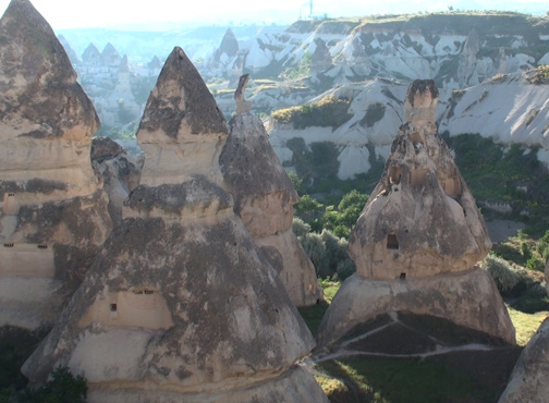
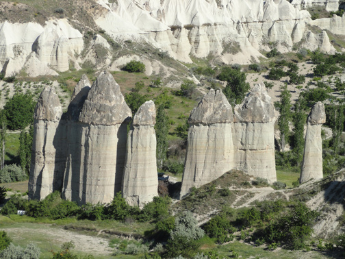
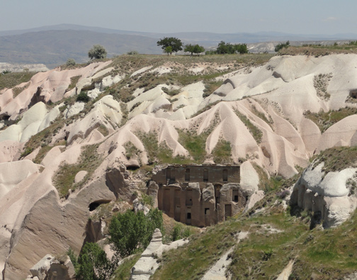
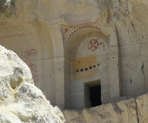
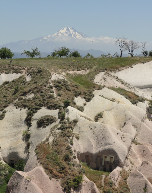
“Cappadocia was a huge underground refuge, and I believe
many areas might date back thousands of years, perhaps even to the
end of the last ice age 12,000 years ago when Gobekli Tepe was constructed.”
- Robert M. Schoch, Ph.D., Geologist, Boston University
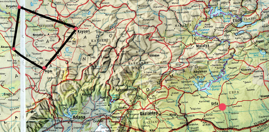
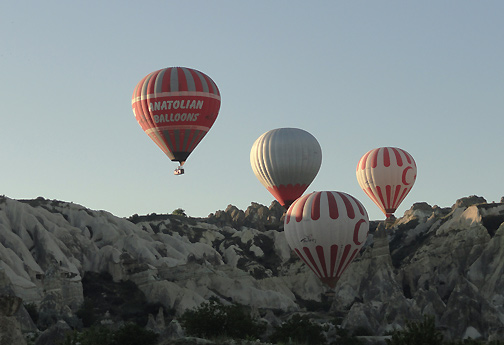
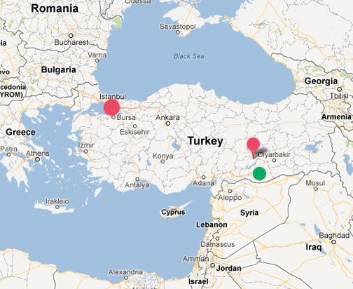
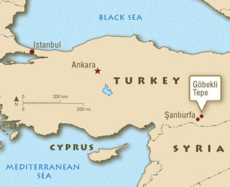
July 2, 2012 Cappadocia Region southeast of Ankara, Turkey, in ancient Anatolia - The western frontier of Asia known as Asia Minor was the region of Anatolia that encompassed the central uplands of modern Turkey from the coastal plain of the Aegean Sea east to the mountains on the Armenian border and from the narrow coast of the Black Sea south to the Taurus mountains and Mediterranean coast.
Click here to subscribe and get instant access to read this report.
Click here to check your existing subscription status.
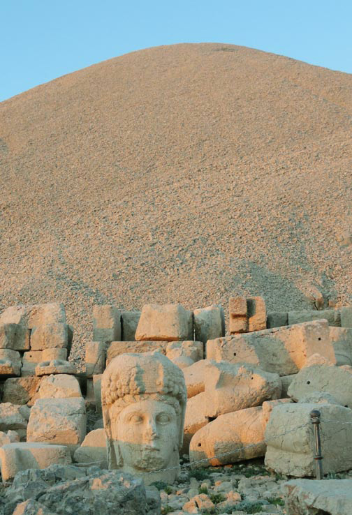
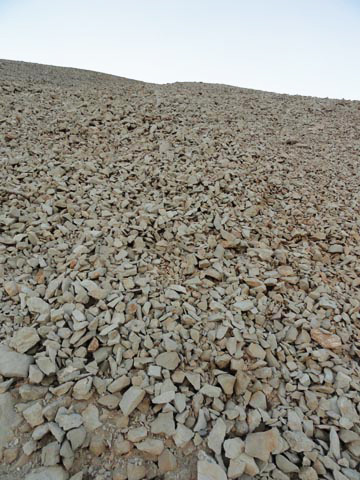
“Mt. Nemrut is clearly an artificial peak on top of the mountain.
It’s piled up with gravel purposefully ... of a certain size,
of a certain shape so ... it’s actually a very sophisticated pile of gravel.”
- Robert M. Schoch, Ph.D., Geologist, Boston University
June 28, 2012 Mount Nemrut 25 miles north of Kahta, Turkey - On June 11, 2012, we traveled to see the “8th Wonder of the Ancient World,” Mount Nemrut. It's a 7,000-foot-high mountain (2,134 meters) north of Gobekli Tepe and about 25 miles (40 km) north of Kahta, Turkey. Historically, the astounding mountain burial monument disappeared from world consciousness for two thousand years until re-discovered in 1881 by a German engineer named Charles Sester, who was studying Ottoman transport routes. Then it took until 1953 for any professional archaeological research to be done.
Click here to subscribe and get instant access to read this report.
Click here to check your existing subscription status.
“The divers were swimming slowly over the large circular object and suddenly passed over a ring of stones, like a small Stone Age fireplace, on the right side.”
- Peter Lindberg, Co-Owner, Ocean Explorer, Stockholm, Sweden
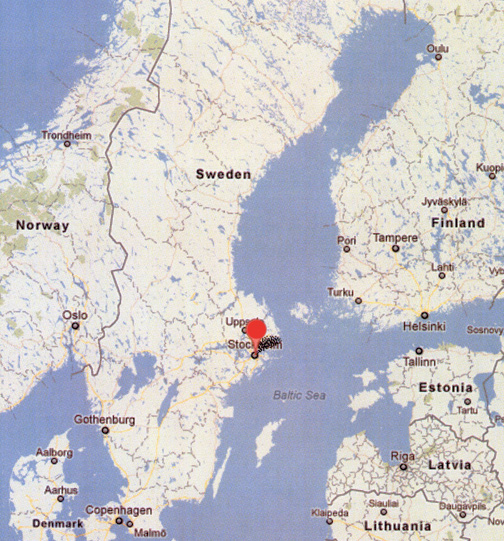
June 28, 2012 Stockholm, Sweden - Two long-time divers who joined together in the mid-1990s to hunt for sunken treasure in shipwrecks at the bottom of the Baltic are Peter Lindberg and Dennis Asberg. They are co-owners of Sweden Ocean Explorer, a Stockholm company devoted to searching for sunken shipwrecks and treasure, who call themselves the Ocean X Team.
Click here to subscribe and get instant access to read this report.
Click here to check your existing subscription status.
“All the work Gobekli Tepe builders put into carving those pillars,
erecting them, erecting walls between them at a later stage... is in many
ways dwarfed by the amount of time and work and energy
they put into covering them over again.”
- Robert M. Schoch, Ph.D., Geologist, Boston University
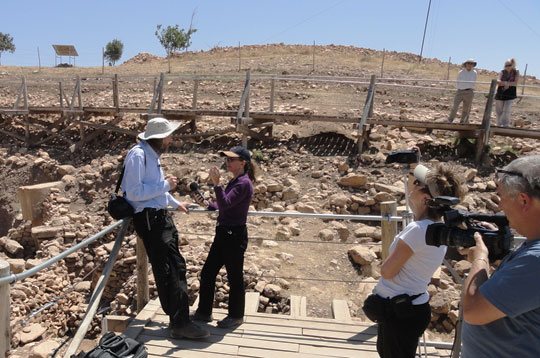
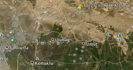
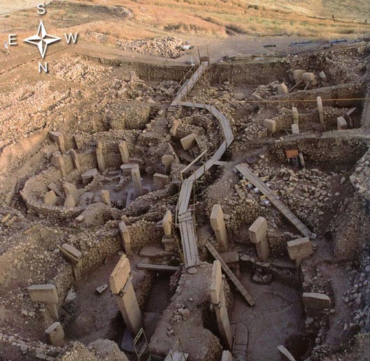
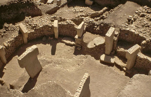
Earthfiles Reporter and Editor Linda Moulton Howe interviewed Robert M. Schoch, Ph.D., Geologist, Boston University, inside the Gobekli Tepe, Turkey, excavation site on June 13, 2012. Right is Jennifer Stein running video camera for Linda and Leo Skorpion, videographer, Skorpion Film Production. Image by Gregory Poplawski for Earthfiles.com.Yellow marker at coordinates for Gobekli Tepe: 37.223237° N, 38.922546° E Gobekli Tepe in Turkish means “Potbelly Hill,” an archaeological site about eight miles northeast of Sanliurfa not far from the Syrian border. The region's water comes from the Euphrates, the longest river of Western Asia, that originates upstream from Keban, Elazig Province in eastern Turkey.
June 26, 2012 Gobekli Tepe, Turkey - After the sun had risen to completely light up Gobekli Tepe, I interviewed geologist Robert M. Schoch, Ph.D., inside the Gobekli Tepe excavation. I asked him if given that Gobekli Tepe's creation and purpose is perhaps the greatest archaeological and historical mystery on the planet today, what does Dr. Schoch speculate happened a thousand years after the elegant, bizarre, strangely eerie pillars, totem, Urfa man and other sculptures were erected in circles over 30 hilltop acres to cause Someone to cover the whole site back over with dirt?
Click here to subscribe and get instant access to read this report.
Click here to check your existing subscription status.
“Nanodiamonds only form under very high temperatures
and pressures consistent with a major cosmic impact event.”
- Douglas Kennett, Ph.D., Univ. of Oregon
Gobekli Tepe, Turkey: 37.223237° N, 38.922546° E Gobekli Tepe in Turkish means “Potbelly Hill,” an archaeological site about eight miles northeast of Sanliurfa/Urfa not far from the Syrian border. Urfa city lights in background.
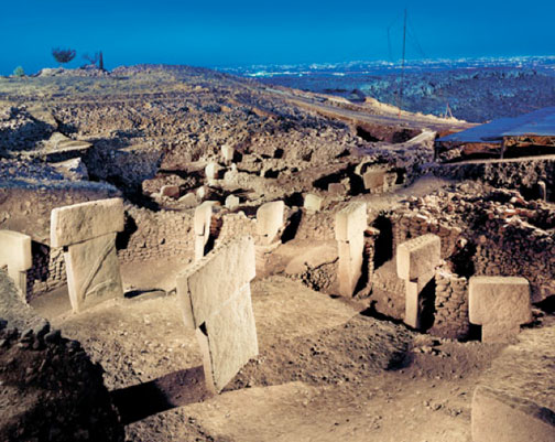
June 21, 2012Gobekli Tepe 8 miles northeast of Sanliurfa, Turkey - Who made the 30 acres of elegantly carved Gobekli limestone pillars in circles? And why? More baffling, who? or what? was gathering up tons of soil and carefully piling it over the 30 acres of 19-foot-high, T-shaped limestone pillars - covering them up a thousand years after the pillars had been sculpted by Someone? These 12,000-year-old circles of limestone pillars, cemented bases and brick walls are more than twice the age of Mesopotamia! Was Gobekli being protected because Gobekli creators had foreknowledge about a coming catastrophe? The effort needed to erect so many large stone circles over some 30 acres - and then have to bury all those pillars again centuries later – is beyond understanding. What exactly was the process to re-bury all the pillars?
Click here to subscribe and get instant access to read this report.
Click here to check your existing subscription status.
“The T-shaped pillars have an anthropomorphic identity. But who are they?As their faces are never depicted, they seem very likely to be related to supernatural beings, beings gathered at Gobekli Tepe for certain,
but so far unknown, purposes.”
- June 2012 Issue of Actual Archaeology Magazine-Anatolia,
“The First Temple of the World: Gobekli Tepe.”
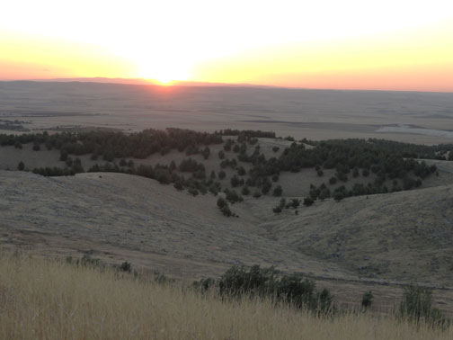
June 18, 2012Gobekli Tepe 8 miles northeast of Sanliurfa, Turkey - As the sun rose on the eastern horizon June 13, 2012, I first faced the sun and then turned 180 degrees to face the opposite point in the west. Below me in the Gobekli Tepe Section C, a large pillar is cemented to a rectangular base like an altar. On that altar-pillar is a long-bodied animal that doesn't quite match any known Earth animal today. With the sun shining on my back, that pillar animal was facing me on an east-west axis.
Click here to subscribe and get instant access to read this report.
Click here to check your existing subscription status.
“What was so important to these early people that they gathered to build (and bury) the stone rings? The gulf that separates us from Gobekli Tepe's builders is almost unimaginable.”
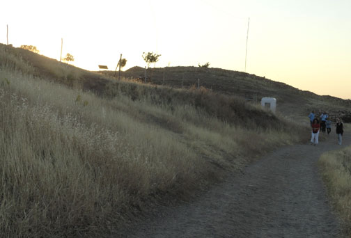
June 16, 2012 Gobekli Tepe 8 miles northeast of Sanliurfa, Turkey - On Wednesday, June 13, 2012, as the sun rose I was standing on the Gobekli Tepe hilltop in southern Turkey not far from the Syrian northern border. Carbon dated to 12,000 years ago, Gobekli is older than Egypt, Sumeria, classical Greeks and Stonehenge. Ramps have been built to walk around the archaeological excavations of mysterious 10 to 19-foot-tall, elegantly carved limestone pillars placed carefully in circular patterns. There are at least 30 acres of the pillar circles a thousand feet above the valley floor. Each pillar weighs 10 to 20 metric tons. Many are sculpted with odd, even unrecognizable, animals, insects and humanoid figures to be detailed in Part 2. A few unfinished pillars have been found that are 23 to 30 feet long, much larger than any of the finished standing pillars found so far. There is evidence that the pillars were roofed and that the central pair of tallest pillars may have supported a roof. The floors are made of burnt lime, similar to Roman terrazzo. The limestone slabs were quarried from bedrock pits located around 100 meters (330 ft) from the Gobekli hilltop.
Click here to subscribe and get instant access to read this report.
Click here to check your existing subscription status.