“...the Ballistic Missile Early Warning System (BMEWS) construction
could have been used as a cover up for the assembly of a group of highly technical people to all of a sudden leave their families and jobs in the States to fly to Alaska.”
- Retired Navy Captain

Return to Part 1.
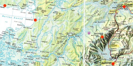
September 2, 2012 Albuquerque, New Mexico - The alleged underground pyramid structure west of Mount McKinley has provoked a lot of email since my original Earthfiles and Coast to Coast radio interview with Doug Mutschler, retired U. S. Army Counterintelligence Warrant Officer, with information about an underground pyramid was posted on July 26, 2012. See: Updated Parts 1 - 3: 072712 Earthfiles.
Click here to subscribe and get instant access to read this report.
Click here to check your existing subscription status.
Existing members, login below:
© 1998 - 2025 by Linda Moulton Howe.
All Rights Reserved.

