“Cappadocia was a huge underground refuge, and I believe
- Robert M. Schoch, Ph.D., Geologist, Boston University
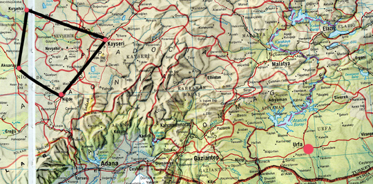
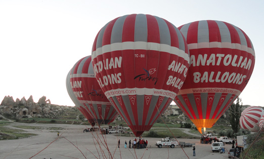
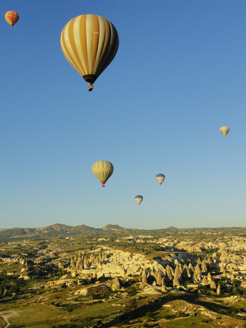
Above: The Cappadocia region is southeast of Ankara, Turkey, in the Nevsehir Province and bounded by the four cities of Kirsehir (top left red circle); Aksaray (far left red circle); Nigde (lowest red circle in black outlined Cappadocia); and Kayseri (far right red circle in black outline). Urfa and nearby Gobekli Tepe are the red circle in lower right near Turkey and Syria border. Below: Anatolian Balloons firing up on June 11, 2012, before sunrise to take tourists for balloon rides over the spectacular and eerie volcanic landscapes of Cappadocia where Anatolians have carved homes in pointed lava ash domes and made underground cities for millennia. Balloon image © 2012 by Linda Moulton Howe.
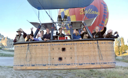
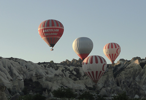
Robert Schoch's Cappadocia balloon group rising from ground at sunrise on June 11, 2012. Above and below: Anatolian and other balloons rising over volcanic landscape of Cappadocia, Turkey, on June 11, 2012. Image © 2012 by Linda Moulton Howe.
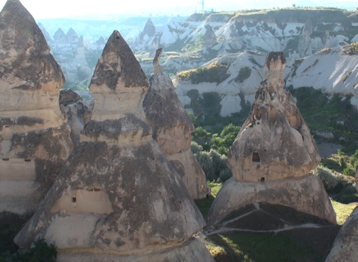
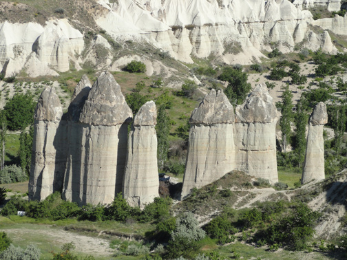
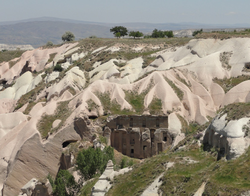
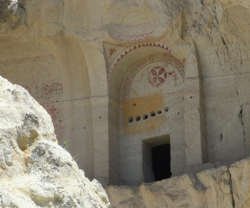
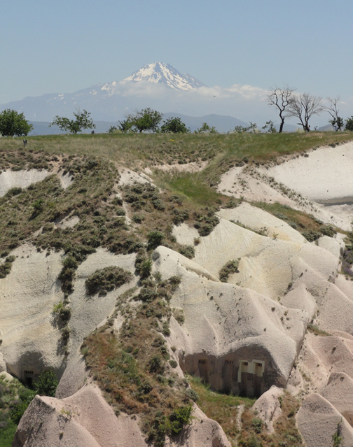
Fairy chimneys of Pasabag and Monks Valley where historians of the region say that Saint Simon in the 5th Century A.D. moved into one of the fairy chimneys to be alone after rumors that he created miracles. Image © 2012 by Linda Moulton Howe. Tufa cones from Goreme in the Kiliclar Valley of Cappadocia, Turkey. Image © 2012 by Linda Moulton Howe. Uchisar gets its name from a Hittite castle built long ago on the ancient Silk Road in the pinkish-beige volcanic rock formations. Today there are large apartment buildings that house many people. The temperature inside remains the same allthrough the year. Expansions occur by simply carving into more surrounding volcanic rock. Image © 2012 by Linda Moulton Howe. The Bible's Acts of the Apostles describes how Saul of Tarsus, Anatolia, was traveling to Damascus, Syria, when a strong light appeared in the sky that caused Saul to fall off his horse. A voice from heaven said, “Saul, why do you persecute me?” Saul asked, “Who are you, Lord?” The voice replied, “I am Jesus, whom you are persecuting.” (Acts of the Apostles 9:5) Saul changed his life to champion Christ and became known as St. Paul. In the Cappadocia volcanic rocks of Antakya, the first church dedicated to Christ was carved. Since then, many churches have been carved into Cappadocia volcanic rock such as the one above. Image © 2012 by Linda Moulton Howe. Mount Erciyes rises 12,848 feet (3,916 meters) above the Cappadocia plateau in foreground that is covered with volcanic ash mounds and “fairy houses” from this central Turkey region that had persistent volcanic eruptions millions of years ago from half a dozen volcanoes. Those continuous ancient eruptions produced the Mid-Anatolian Plateau with masses of lava and ash that are 656 feet (200 meters deep). It is possible that the Hipparion ancestor of the modern horse was killed off by all the volcanic eruptions. Image © 2012 by Linda Moulton Howe. July 2, 2012 Cappadocia Region southeast of Ankara, Turkey, in ancient Anatolia - The western frontier of Asia known as Asia Minor was the region of Anatolia that encompassed the central uplands of modern Turkey from the coastal plain of the Aegean Sea east to the mountains on the Armenian border and from the narrow coast of the Black Sea south to the Taurus mountains and Mediterranean coast.
Click here to subscribe and get instant access to read this report.
Click here to check your existing subscription status.
Existing members, login below:
