"The physical data knocks out the chance that people hoaxed this. People just cannot hoax the expulsion cavities and they cannot elongate the growth nodes..."
- Jeffrey Wilson, ICCRA

Return to Part 1: U. S. Crop Formations in Epps, Louisiana, and Red Bluff, Calif.
Return to Part 2: U. S. Crop Formations, Two Mysterious Grass Circles in Mission, Kansas.
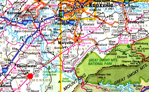
June 7, 2007 Williamsburg, Ohio - On May 24, 2007, I received a phone call from Jeffrey Wilson, Director of the Independent Crop Circle Research Association (ICCRA) in Williamsburg, Ohio, telling me that the Monroe County Buzz newspaper in Madisonville, Tennessee, had a headline about a crop formation in a wheat field. Madisonville, Monroe County, Tennessee - site of the historic Cherokee nation's capital, Chota - is straight south of the Oak Ridge National Laboratory outside Knoxville and west of the Great Smoky Mountains (red circle on map).
Click here to subscribe and get instant access to read this report.
Click here to check your existing subscription status.
Existing members, login below:
© 1998 - 2025 by Linda Moulton Howe.
All Rights Reserved.

